UE oferă sprijin pentru dezvoltarea sistemelor de cartografiere și cadastru din Republica Moldova
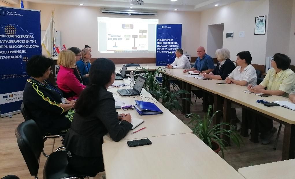
În prezent, datele spațiale se bucură de tot mai multă importanță, înțelegere și utilizare. Respectiv, buna organizare și funcționare a sistemelor de cartografiere și cadastru ajung să dețină rolul cheie în țară, servind în calitate de motor pentru dezvoltarea economică a acesteia. Având rolul de elaborator de politici pentru sectorul cadastral și rolul dublu de elaborator de politici și implementator pentru sistemele de geodezie și cartografiere, Agenția Relații Funciare și Cadastru (ARFC) a Republicii Moldova a găzduit înalți reprezentanți din partea Administrației Geodezice de Stat din Republica Croația și din partea Cadastrului Olandez în iunie și iulie 2023, în inițiativa comună a partenerilor de proiect de a efectua o evaluare comprehensivă din punct de vedere organizațional, strategic și juridic a următoarelor sisteme din Republica Moldova: cadastru, cartografiere, evaluarea bunurilor imobile, managementul funciar și protecția solurilor, și de a oferi recomandări pentru alinierea ARFC la o autoritate de cartografiere și cadastru de nivel european. Misiunile au avut loc în cadrul proiectului UE Twinning „Îmbunătățirea serviciilor de date spațiale în Republica Moldova conform standardelor UE”, implementat de un consorțiu alcătuit din instituții partenere din Croația, Țările de Jos și Polonia.
Această activitate a implicat numeroase discuții și ședințe cu toate direcțiile, serviciile și unitățile din cadrul ARFC, precum și cu alte instituții, ale căror sarcini și responsabilități se intersectează cu competențele legale ale ARFC. Aceste instituții au inclus: Întreprinderea de Stat “Institutul de Geodezie, Prospecțiuni Tehnice și Cadastru” (INGEOCAD), Departamentul Cadastru de la Agenția Servicii Publice, Întreprinderea de Stat “Institutul de Proiectări pentru Organizarea Teritoriului” (IPOT). Dat fiind faptul că funcțiile de bază ‘orizontale’ asociate cu administrarea funciară sunt la moment dispersate între câteva organe publice și întreprinderi subordonate, experții pe termen scurt au analizat cadrul juridic, în scopul identificării interconexiunii și divizării clare a sarcinilor și atribuțiilor instituțiilor, precum și principalele provocări ce împiedică funcționarea eficientă a acestor sectoare în Republica Moldova. În rezultatul misiunilor, au fost elaborate recomandări preliminare pentru a îmbunătăți situația în sectoarele menționate mai sus.
Deoarece Republica Moldova a adoptat calea de integrare în Uniunea Europeană și a primit statutul de țară candidat în iunie 2022, există necesitatea de a urma o abordare consolidată pentru managementul cadastral, al registrului funciar și al informației despre bunurile imobile, precum și de a dezvolta sectoarele de geodezie, cartografiere, geo-informatică și evaluarea bunurilor imobile.
Proiectul Twinning ”Îmbunătățirea serviciilor de date spațiale în Republica Moldova conform standardelor UE” este finanțat de Uniunea Europeană și implementat de către Agenția Relații Funciare și Cadastru (ARFC).


