Vizite de studiu în Croația și Polonia pentru experții Agenției Relații Funciare și Cadastru, facilitate de proiectul Twinning finanțat de UE
Vara anului 2022 a adus o nouă dinamică proiectului Twinning „Îmbunătățirea serviciilor de date spațiale în Republica Moldova conform standardelor UE”. Odată cu ridicarea restricțiilor de călătorie legate de COVID-19, o serie de noi activități au demarat în perioada iunie-august 2022. Noutatea acestei perioade a fost cele două vizite de studiu mult așteptate, care au avut loc în Croația și Polonia. Împărtășindu-și experiențele și bunele practici, experții din ambele state membre ale UE au oferit beneficiarilor idei noi și perspective cu privire la modul de dezvoltare a Infrastructurii Naționale de Date Spațiale (INDS) în propriile instituții din Republica Moldova.
În perioada 6-10 iunie 2022, o echipă de nouă experți de la Agenția Relații Funciare și Cadastru (ARFC) și Î.S. INGEOCAD a participat la prima vizită de studiu în Zagreb, Croația. Experții Administrației Geodezice de Stat din Croația (AGS) și-au împărtășit propria experiență legată de stadiul implementării Directivei UE INSPIRE, geoportaluri, tehnologia LIDAR, proiectele finanțate de UE și alte activități legate de INDS din cadrul instituției. De asemenea, delegația Republicii Moldova a avut ocazia să se întâlnească cu alți experți care se ocupă de INDS la primăria Zagreb, Ministerul Economiei și Dezvoltării Durabile, Agenția de Plăți pentru Agricultură, Pescuit și Dezvoltare Rurală, Serviciul Meteorologic și Hidrologic Croat, Serviciul Salvamont, precum și Facultatea de Geodezie, Universitatea din Zagreb.
În plus, din 27 iunie până la 1 iulie 2022, nouă participanți care au reprezentat ARFC, Î.S. INGEOCAD, Agenția Servicii Publice (Departamentul Cadastru), Î.S. Institutul de Proiectări pentru Organizarea Teritoriului (IPOT), Î.S. Administrația de Stat a Drumurilor, Primăria Ungheni și Î.S. Institutul de Cercetări și Amenajarea Silvice (ICAS) s-au alăturat vizitei de studiu în Varșovia, Polonia. Beneficiarii au fost familiarizați cu modul de utilizare a INDS din cadrul Oficiului Polonez pentru Geodezie și Cartografie (GUGiK) și a altor entități administrative din Polonia, precum Biroul Central de Statistică și Centrul Municipal de Documentare Geodezică și Cartografică din Cracovia. Ei au oferit informații clare despre cum se păstrează documentele, se înregistrează terenurile și clădirile, precum și dezvoltarea sistemului de informații spațiale municipale.
Pe lângă vizitele de studiu, în cadrul Componentei 1, Crearea unei guvernări durabile a INDS, s-au înregistrat progrese la Raportul de Licențiere care conține toate tipurile de licențe (specifice și deschise, comerciale și necomerciale) elaborate pentru anumite scenarii relevante la situația actuală din Republica Moldova.
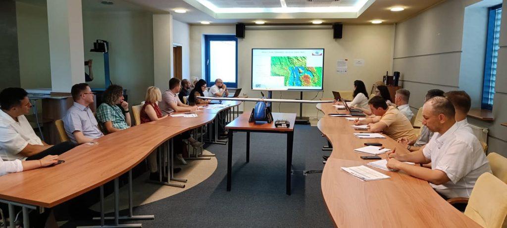
În cadrul Componentei 3, Utilizarea datelor existente în cadrul INDS este posibilă, misiunea a fost efectuată la mijlocul lunii iulie 2022, cu participarea la fața locului a experților de la AGS. În urma ședințelor de lucru a fost întocmit Raportul privind fluxurile informaționale și prelucrarea datelor. Scopul acestui raport este de a oferi o privire de ansamblu asupra fluxului de lucru pentru obținerea, diseminarea și metodologia de întreținere a seturilor de date pentru transferul de date, de a oferi informații de bază despre managementul Datelor Geospațiale Mari, precum și de a oferi recomandări pentru fluxurile de informații și prelucrarea datelor ale seturilor de date pentru care ARFC este responsabilă.
Referitor la activitățile orizontale ale proiectului, în iunie 2022, în urma acordului tuturor părților implicate, implementarea proiectului Twinning a fost prelungită oficial cu încă 6 luni. Un alt eveniment cheie pentru proiect în această perioadă a fost cea de-a opta reuniune a Comitetului de Guvernare organizată în premieră în instituția beneficiară (ARFC), la data de 14 iulie 2022. Participanții au aprobat în unanimitate al șaptelea raport trimestrial și planul de lucru în desfășurare nr. 8 pentru perioada următoare.